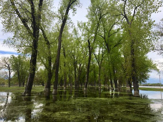
Climate driven changes in hydrology and flooding threaten the health and functionality of floodplain forests of the Upper Mississippi River, which represent critical habitat to hundreds of species including birds, mammals, amphibians and reptiles.
Challenge: Future flooding could undermine conservation efforts by managers to maintain the health of forests as widespread losses of these ecosystems are already underway.
Principal Investigator(s):
- Molly Van Appledorn (USGS Upper Midwest Environmental Science Center)
Co-Investigator(s):
- Marcella Windmuller-Campione (University of Minnesota)
- Daniel Griffin (University of Minnesota)
- Laura Reuling (University of Minnesota)
- Matthew Trumper (University of Minnesota)
Partners:
- U.S. Army Corps of Engineers
- U.S. Fish and Wildlife Service
- U.S. Forest Service
- Minnesota Department of Natural Resources
- Wisconsin Department of Natural Resources
Floodplain forests along the Upper Mississippi River are heavily managed but understudied systems that provide critical ecosystem services, including habitat for endangered species. Impacts of a changing climate, such as warmer winters and wetter summers with extreme precipitation events, are already influencing hydrologic patterns in these ecosystems, including altering the duration, frequency, and timing of floods. These changes bring numerous challenges to floodplain forest managers. This project will leverage an already established research-management partnership to develop knowledge and tools to inform sustainable decision making.
In this project, researchers will utilize multiple sources of “big data” to explore and quantify the relationship between forest structure, composition, and age with important environmental drivers like flooding. Researchers will also utilize multiple forms of data to map how current impacts from climate change are influencing environmental conditions on the floodplain, identifying locations that are more climate-resilient and less climate-resilient to efficiently utilize management resources. Finally, the researchers will input these data into LANDIS-II, a landscape-level model of forest change to forecast potential shifts in vegetation associated with climate change and different management strategies.
This effort will bring together multiple partners for both trainings and knowledge sharing to link the results to future adaptive management scenarios. Throughout the project, there will continue to be two-way communication between the research team and stakeholders through both formal and informal meetings, webinars, field events, and write-ups. Results from this project will be shared with partners during regular collaboration meetings in addition to traditional scientific outlets such as papers and conferences. Additionally, the research team will offer a training session for partners interested in using the produced models for their custom applications.
Read more from CASC Project Explorer.
